The Right of Way
Footpath Lewes 60
Footpath Lewes 60 is a public footpath. East Sussex County Council confirmed the Order recording it on 2 October 2026, and it took effect that day. No one objected to the Order, including the owner of the land.
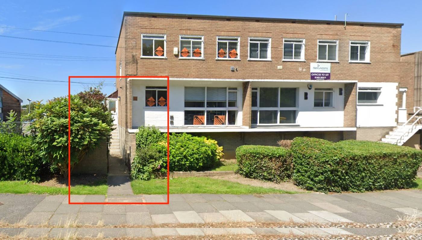
For decades people walked freely from the passageway beside 48 Malling Street, along the service road behind Caffyns, to the Brooks Road roundabout. Lidl closed the route in June 2025. Residents gathered the evidence, and the County Council has now recorded it as a public footpath, so the landowner can no longer treat pedestrian access as an optional feature of their development.
The confirmed Order
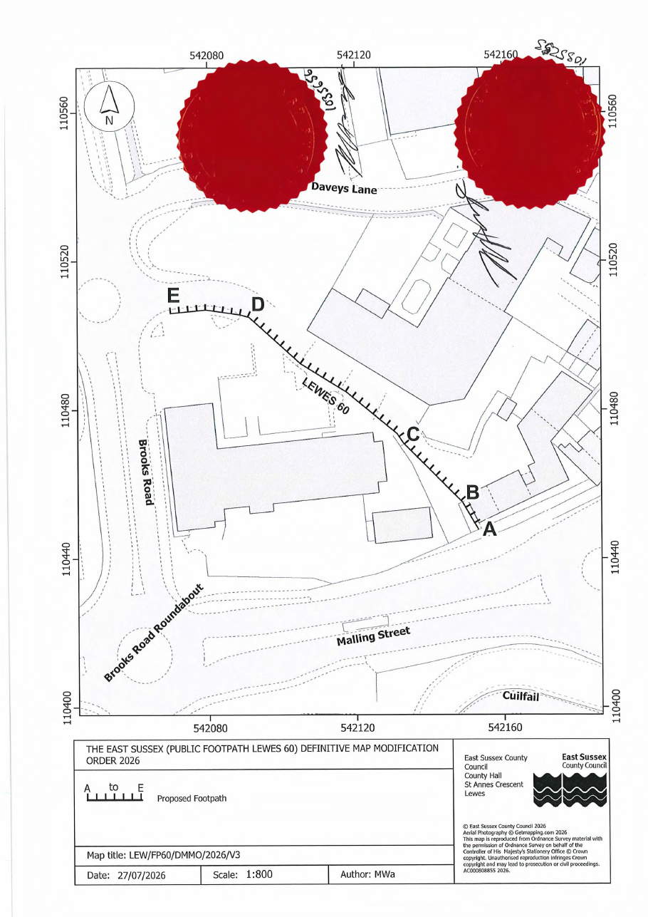
- The route: about 110 metres from Malling Street (point A) to Brooks Road (point E), across the Brooks Road site.
- Width: about 1 metre for the first few metres from Malling Street, then 2 metres.
- Gates: the Order records a pedestrian gate at the Malling Street end and a double five-bar gate at point C.
- The documents: The confirmed Order and plan (PDF) · The notice of confirmation (PDF) · on the County Council's website, reference RWO 330: rights of way map and register.
What happens next. Until 20 November 2026, anyone can ask the High Court to quash the Order, but only on legal grounds: that the Council lacked the power to make it, or did not follow the required procedure. It is not a chance to re-argue the evidence. If no one applies, the Council will then add the path to the Definitive Map and Statement, the official record of public rights of way.
The footpath and Lidl's application
No document in Lidl's application (SDNP/26/03583/FUL) mentions the footpath, other than the application form, which answers yes to the question whether a right of way would need to be diverted or created.
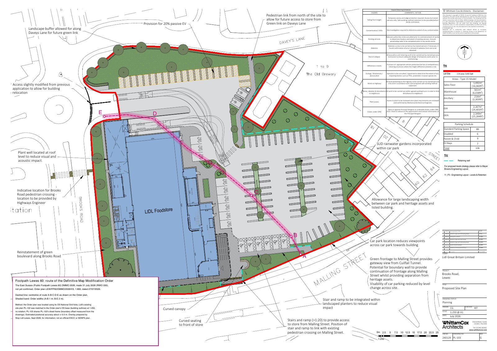
The overlay's legend predates the confirmation of the Order on 2 October 2026.
Lidl's plans show their own pedestrian route instead, round the store and through the car park. It is longer and less direct than the Order route, and runs through the supermarket's car park and past its only vehicle entrance.
We have plotted the Order's own grid references onto Lidl's submitted site plan. The route crosses the lorry turning and service area, clips the north-east corner of the store (about 5 metres of the route's centre line falls inside the building) and crosses the car park. The overlay is the campaign's own work, not an official plan, and is accurate to about half a metre.
The County Council's Rights of Way team has commented on the application. It says the plans do not accommodate Footpath Lewes 60, and asks how the footpath will be accommodated and, if a diversion is proposed, for a plan of the existing and proposed routes. Read the comments on the Authority's website
Every document in Lidl's application, with a summary and the points we think the Authority should weigh, is on our application documents page. Search it for “footpath”.
Planning permission does not move a footpath
- The footpath stays where it is unless a separate legal order diverts it. Planning permission alone does not do that.
- A diversion needs its own order. It would be made by the planning authority, publicly advertised, and open to objection. If objections are not withdrawn, the decision goes to the Secretary of State.
- The tests are strict. A diversion can be made only where it is necessary for the development to go ahead, and the loss to people who use the path can be weighed against it.
Our aim is to keep the route as the Order records it, and to oppose any diversion that is longer, less direct, or routed through a busy car park.
What you can do
- Comment on the application to the South Downs National Park Authority, reference SDNP/26/03583/FUL. Say that the plans ignore Footpath Lewes 60 and do not show how it would be kept open. There is no closing date: comments are accepted until the application is decided. Go to the application on the Authority's website
- If a diversion order is ever advertised, object to it. We will post the details here.